
On a warm autumn afternoon at Wheeler Historic Farm in Murray, Utah, families pet baby farm animals and take hayrides under falling leaves. Just a few yards away from the autumn festivities, five members from Salt Lake County are hard at work. Their restoration project will strengthen the watershed for years to come with thousands of perennial plants lined up along Little Cottonwood Creek.
Mark Roia is a watershed scientist and planner for Salt Lake County. By collecting data, he and his team identify and address multiple impairments to watershed sites across the county. An impairment occurs when a creek or river is unable to fulfill its intended purpose, whether agricultural, recreational or culinary. The site along Little Cottonwood Creek at Wheeler Historic Farm is impaired due to abnormal levels of bacterial germs known as E. coli, which Roia describes as an anthropogenic impact from human usage.
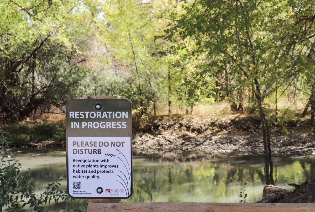
This is the second year of restoration at the site, according to Megan Butler, manager of the Wheeler Farm site and watershed scientist and planner at Salt Lake County. Their first-year efforts included a fence enclosing the surrounding area of the creek to ensure minimal human impact, allowing the stream to naturally create a vegetative buffer to filter pollutants. The goal for 2025 is to enhance the vegetative buffer further by planting thousands of native perennial plants.
“It is an exciting project because it’s right in the middle of the valley, it’s a very public space, it’s used in a lot of different ways,” said Butler. “And it’s a place where we’re already monitoring water quality, so hopefully we can see some of the direct impacts of our work.”
Taking Root
Fall is the perfect season for the county team to seed roughly 4,000 plants to multiple restoration sites. This autumnal advantage is due to the dormant state of the perennials and especially the sod mats, according to Roia. While sod mats for backyards normally contain Kentucky blue grass, these mats contain native wetland sedges and rushes. The roots of all the native plants and mats need a chance to take root and establish in colder temperatures, while also not being at risk of drying out, which is why it is easier to plant natives that have already lost their leaves and gone dormant.
“So if we can get them in the ground now, they have … all the way until next spring to work on the root system … this is the best time. Full stop,” said Roia.
Maple and oak trees will be planted at the top portion of the creek bed, closer to the fencing enclosure. Plants that are more water-dependent will be planted in the riparian zone. These are plants that require constant access to an aquatic ecosystem. Other impairment sites will receive plants specific to the restoration purpose, such as the Butterfield Canyon site, where they will plant over 1,000 willow trees.
“It’s our job to mimic the processes that already exist in their natural system…compared to the invasive weeds,” said Benny Klein, a field technician at Salt Lake County.
The Process of Restoration
 From high up in the Cottonwood Canyons to urban sites in Salt Lake valley, the county watershed team aims to work top-down on restoration. However, if data confirms a site requires immediate attention, that site will be addressed first. Roia explained that these sites become impaired through point source or nonpoint source pollution. Point source pollution is from one identifiable source, while nonpoint source is pollution from multiple sources. This makes addressing the impairment more complicated as there are many factors to consider; the Wheeler Farm restoration site is impaired from nonpoint source pollution.
The data collected by the county is submitted monthly to the state of Utah for evaluation. The state then notifies the watershed team when a site is considered impaired by the state’s standards. Some examples of impairments could be an excessive amount of sediment, low water levels, high water temperatures or abnormal E. coli levels. The County tackles these impairments on a site-by-site basis. Solutions may include covering and vegetating an area, clearing a common access point of the creek or altering land formations to improve water flow.
Their total of about 60 watershed sites are measured for E. coli and other parameters like temperature and pH levels monthly. Collecting this data ensures they can see the restoration results over time. “I know what my E. coli values look like now today, and historically over the past five, 10 years,” said Roia.
Pre- and post-monitoring of a site is essential for Salt Lake County. Even with minimal restoration like fencing enclosures and vegetation buffers, E. coli and other impairment data have been shown to continuously decrease over time. However, the county team will persistently monitor a restoration site for at least five years to determine if additional restoration is necessary.
Types of Gauging
 How does the Salt Lake County Watershed Team collect data? Mark named a quality example of data collected by the county after the 2022/2023 record snow year in Utah. With the creeks and rivers flowing at a record high, the E. coli levels were at a record low. “Dilution is the solution of pollution,” quoted Roia.
This data is collected and measured through Salt Lake county’s different kinds of gauges. The flow of streams is measured by the county stream gauging team. This team totals two people who continuously monitor 21 total stream gauges and 16 precipitation gauges. All data collected is telemetered via radio to this public website.
These gauges measure the elevation of the water, also known as a stage. From that stage they can then determine the amount of water coming downstream. Stages represent different amounts of water in cubic feet per second (CFS). “At this [time of year], this might represent… 25 CFS, 20 CFS. As stage goes up, the [amount coming downstream changes]… 25 becomes 40 CFS, or 100 CFSs. [In this section of the creek], on a big year, we see 600 plus [CFS],” said Roia.
These gauges measure streams in CFS every 15 minutes year-round. However, during runoff season, the gauges measure every three minutes to account for snow melt and to better understand the stages caused by the discharge of water from the melted snow pack. This team also measures the amount of rainfall from the sky through precipitation gauges down to one-hundredth of an inch. According to Roia, the collected gauging data is used by universities, engineers and flood control agencies.
Results You Can See
Salt Lake County field technicians and University of Utah graduates Max Wathen, Jillian Perry and Benny Klein described restoration as some of the most fulfilling work on the watershed team. They take data they have personally collected and apply it to make a difference in the ecosystem.
Wathen emphasized the importance of community involvement, saying, “Collective action is the biggest thing… giving back to get back.” He added, “Many people use resources but do not give back to those systems.”
Megan Butler described her hope for the Wheeler Farm restoration, noting that the fence enclosure has already shown improvements to the impaired site. She also hopes to begin seeing data changes in the water chemistry once the vegetive buffers have been added to 25 essential watershed sites in Salt Lake County.
“I think in the spaces I’ve seen, it’s a remarkable deal to see a change in a year,” said Butler. “I think those are the little successes to celebrate, but, you know, in the grand scheme of things, I think our goals are for those bigger successes that we’ll see over time.”
The team also recommends volunteering at local non-profits in Salt Lake City for individuals interested in helping to protect the watershed and other vital ecosystems in Utah.
As Perry stated, “We all live downstream.”